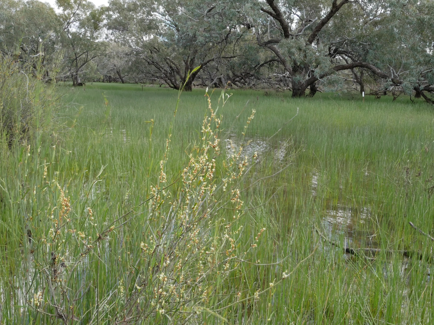
In the first half of 2025, floodwaters flowing south from Queensland and above-average rainfall in the Bourke area contributed to a large flooding event down the Warrego and Darling Rivers and across the Western Floodplain in the Toorale National Park and State Conservation Area.
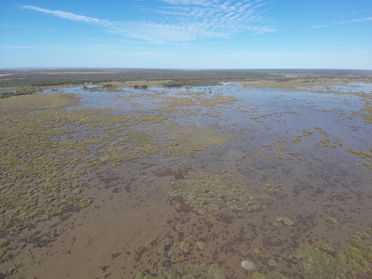
This inundation represents the seventh such event in the six years since the peak of the last major drought in 2019. It was the largest extent of inundation across the Western Floodplain recorded in the Flow-MER Program since monitoring commenced in 2019.
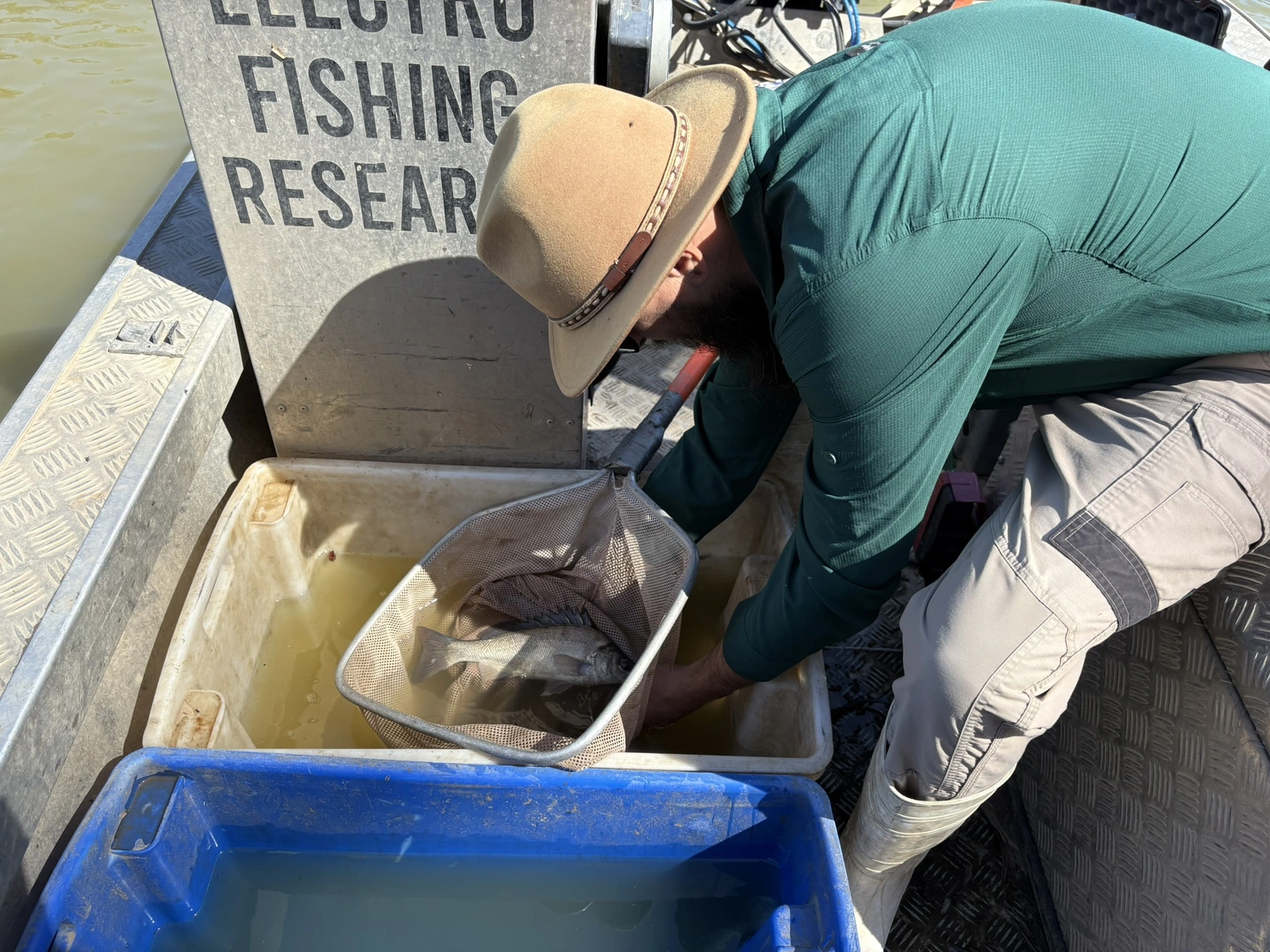
The combination of natural flows and the delivery of Commonwealth environmental water in summer and autumn 2025 contributed a small volume to the Floodplain. Vegetation monitoring was conducted at long-term vegetation monitoring sites, including some sites that had not been inundated since 2020.
Use of environmental water led to enhanced vegetation outcomes in spring 2025, including for vegetation richness, cover, and diversity across all four monitored communities on the Western Floodplain (unpublished data, to be made available with the 2025-2026 Annual Report). This aligns with patterns observed in previous years, where environmental flows have buffered against ecological decline during dry periods.
The University of New England, engaged as a Flow-MER partner in the Darling and Warrego River Systems Area, draws on eleven years of its own data confirming that such flows improve conditions for flood-dependent plant communities.
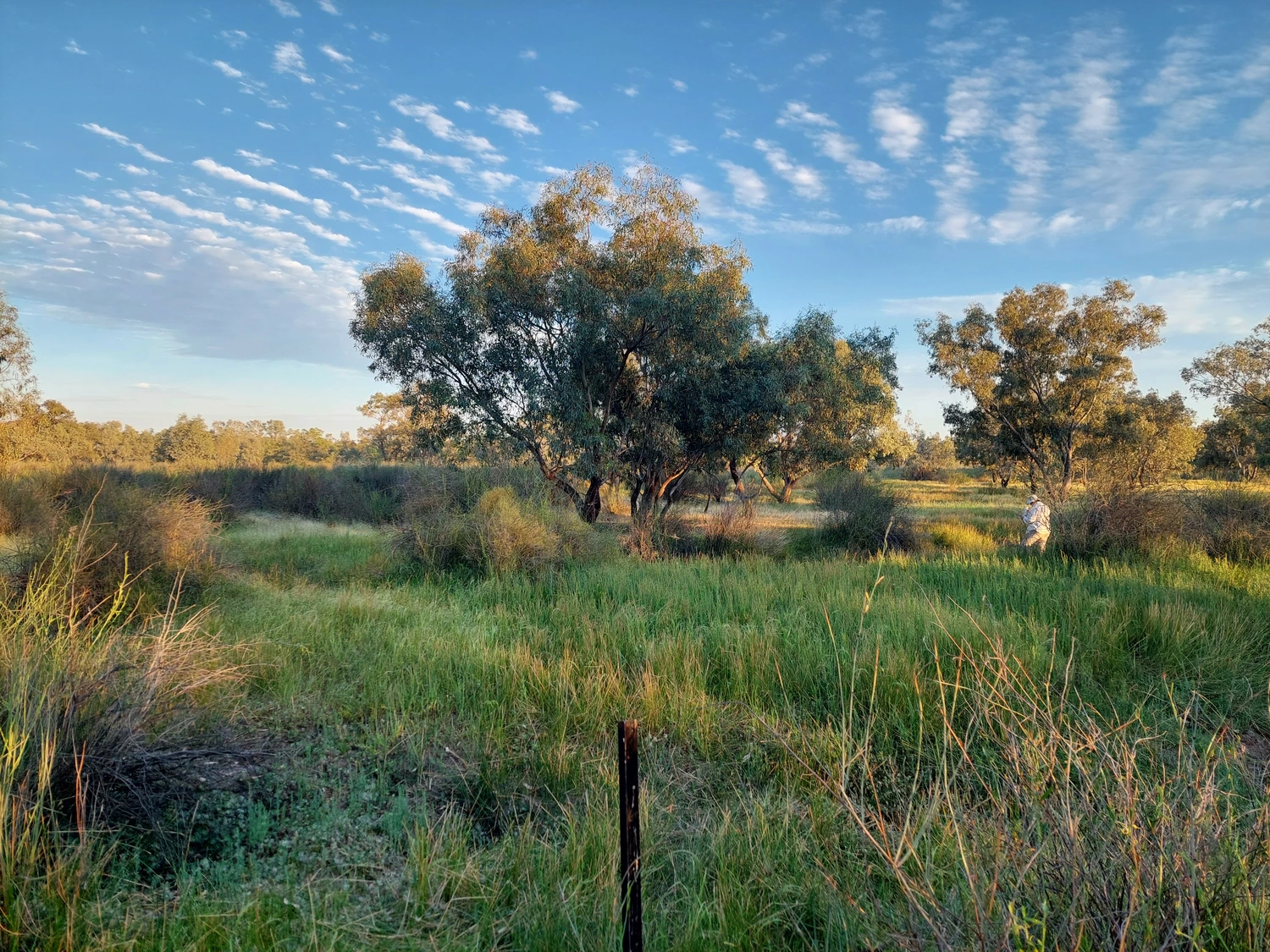
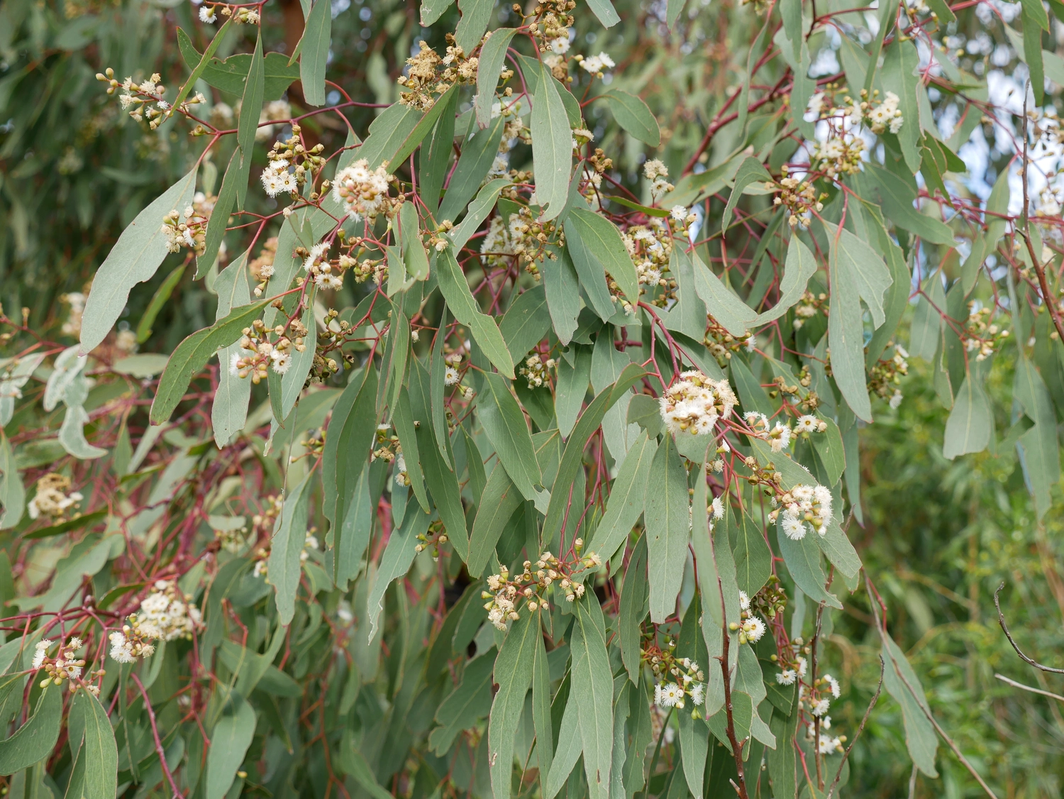
The inundation conditions in autumn-winter 2025 supported the survival and reproductive success of key woody species such as lignum, black box and coolabah. These species showed signs of flowering and seed-setting during the autumn 2025 survey. Flood-dependent species such as flat-leaved spike sedge exploded in numbers, and flowered and fruited prolifically in the wetter conditions.
Prior to the flow, draw-down of the previous floodwaters in spring 2024 after a long period of inundation in autumn and winter led to an increase in species richness and cover from the previous water year across all monitored communities. Widespread inundation and above-average rainfall in early 2025 supported a resurgence in vegetation cover, such as spike rush. Like 2024, the subsequent draw-down of floodwaters was followed by large increases in plant species richness, cover and diversity in spring 2025.
The 2024-25 monitoring results reaffirm that improvements in native plant species richness and cover and plant community composition in the Western Floodplain are closely associated with natural and environmental flows. Vegetation monitoring through the Flow-MER Program has reinforced the critical influence of watering regimes on the health of floodplain vegetation.
Taking a longer-term view, new statistical modelling of inundation impacts on vegetation has provided useful insights for management of the Western Floodplain ecosystems. This includes optimal durations of inundation for maintaining or increasing native plant cover in the four plant communities.
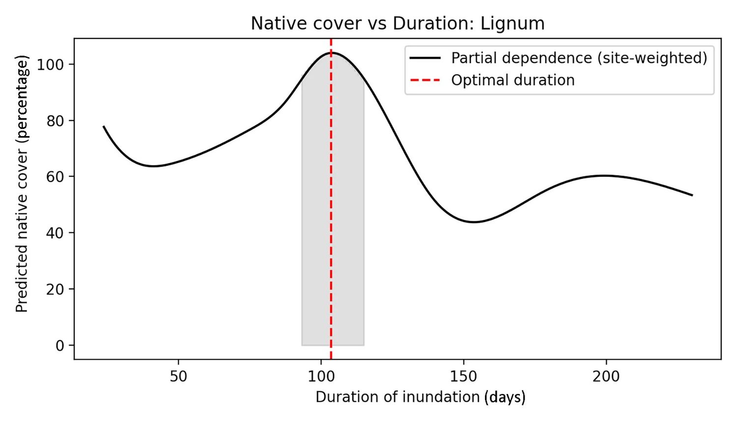
Such insights are extremely useful to water managers for making decisions on whether to provide water to the Western Floodplain, once required conditions have been met. For example, if water should be directed to the Western Floodplain to extend the duration of inundation and help support the completion of plant cycles.
A mosaic of flooding durations and frequencies is required across the targeted plant communities in the Western Floodplain. The length of inundation at Toorale is largely driven by natural events, and the optimal inundation duration has been delivered at a low percentage of the time over the past eleven years (less than 50% of the time in lignum, and less than 30% of the time in cooba, coolabah and chenopod communities). The upgraded construction of the Boera Dam in 2022 allows for improved water delivery to these plant communities. This type of monitoring of vegetation responses to inundation and evaluation of observations will be vital for informing decisions on such water delivery.

.jpg)