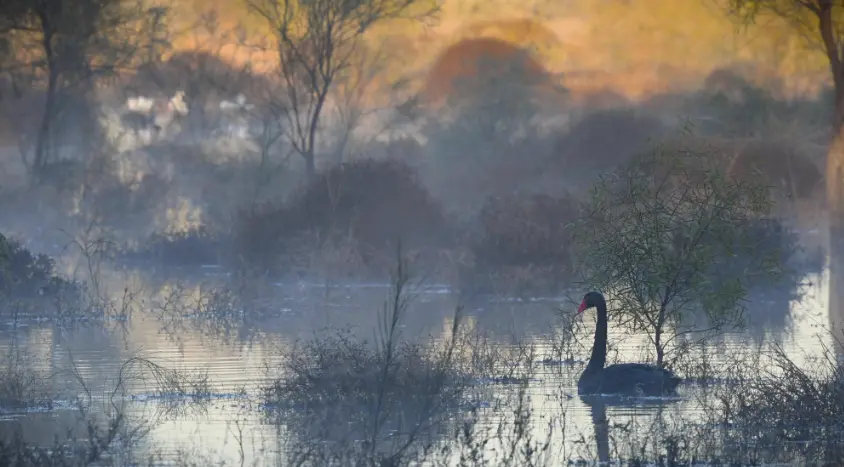
Waterbirds are amazingly mobile, capable of traveling incredible distances.
Understanding why, when, how, and in what ways they move, is important if we want to figure out how best to support their populations in the long-term. It’s also important if we want to know how best to support particular phases of their life-cycle, such as breeding. CSIRO ecologists are working with the Commonwealth Environmental Water Holder to track the movements of waterbird species that are of interest to water and wetland managers, and can be supported through environmental watering. They are using the latest in satellite transmitter technology which is helping to answer these questions:
- When and where do waterbirds move across the Murray-Darling Basin and beyond?
- Are they moving in response to environmental water or flooding?
- What does this mean for our perceptions and predictions of waterbird responses to water management?
- Where are birds feeding, roosting, nesting, when and why?
- What movement and habitat cues, preferences and limitations should we be taking into account in water planning for waterbirds?
- How connected are Australian waterbird populations, spatially and temporally?
- What are the implications for environmental water management to prevent further population declines?

What can satellite-tracking tell us about waterbirds?
- Where, when, how far and how fast they move.
- The exact routes they take.
- Foraging habitat distances from nests and roosts.
- Site selection:fFeeding, sleeping, nesting, shelter.
- Population boundaries and connectivity.
- Cues and triggers: movement, breeding.
- Nesting behaviour, timing, duration.
- Differences between species, sexes, age groups
- Survival and mortality rates and drivers
Types of satellite transmitters and their features
There are a range of different types of satellite transmitters. We select them carefully to suit the bird species being tracked and the information needed for each study. All transmitters are lightweight, being <5% bird bodyweight, and usually only ~1-2%. Transmitters are usually coloured to match the species being tracked.
The three types being used for CEWH Flow-MER satellite tracking are:
- Solar-powered GPS transmitters that use the Argos satellite network.
- Solar-powered GPS transmitters that use phone networks.
- Battery-powered Doppler transmitters that use the Argos satellite network.
No recapture or base station is required for these transmitters because all data upload and download is via satellite networks.
Solar powered transmitters that use the Argos or phone networks can give:
- High frequency location fixes (e.g. every 10 min, 60 min, 3hrs).
- High accuracy location fixes (10’s of metres, usually <15 m).
- Long duration solar-powered tracking (2+ years).
Battery-powered Doppler transmitters aren’t dependent on solar exposure to function and give:
- Moderate frequency location fixes.
- Moderate accuracy location fixes.
- Medium duration tracking of months to years.

“I feel very privileged to be so close to the birds and immersed in the intricacies of their daily lives.” – Freya Robinson, CSIRO
How do we catch the birds and fit the transmitters?
The methods used to catch birds for satellite tracking vary depending on the species and on the location. For colonial-nesting species such as Straw-necked Ibis and Royal Spoonbills, we mostly use leg snares (slip noose traps), and sometimes hand-capture, hand-net or hand-held net-launchers.


For Australasian Bitterns, we use cage traps with call playback, mirrors and sometimes bait (e.g. mealworms). For ducks and other species, we might use any of these methods, including our whoosh-net, mist-nets, or spotlighting.


Depending on the transmitter type and material, a Neoprene pad is often incorporated to provide an insulated cushion between the transmitter and the bird’s back. This makes the transmitter more comfortable as well as reducing the chances of feathers covering the solar panel.
When first fitted, the transmitter and harness sometimes appear obvious on the back of the bird, but over a short period they ‘settle’ into the bird’s feathers. Some types are visible via their aerials; others do not have aerials but instead may have a raised solar panel.

What information about the tracked birds is collected?
Biological samples taken while the bird is in-hand include:
- Feathers (3-5).
- Oropharyngeal swabs (inside beak/trachea).
- Cloacal swabs (rear end).
- Blood sample.
- Parasites.
- Voluntary crop regurgitate.
- Scats (droppings).
- Eggshells from hatched eggs at the bird’s nest.
These samples are stored and eventually used to test for the presence of diseases and toxins such as pesticides and poisons, as well as general health, diet and genetics. Taking samples while the bird is ‘in-hand’ is an efficient and effective measure to gain the maximum possible information from each satellite-tracked individual. It also helps to explain population structure and declines.

How do we access and use the satellite data?
Each transmitter manufacturer and data provider has its own way of providing access to the data. Data downloads are done weekly, either via websites or proprietary software. We then take those downloads and use them along with environmental information to create collated datasets and maps, including:
- Movement datasets: Multi-scalar spatial and temporal movement datasets for selected waterbird species.
- Habitat selection datasets: Multi-scalar spatial and temporal habitat selection datasets for selected waterbird species.
- Maps showing individual and grouped waterbird movements at a range of spatial and temporal scales.
- Maps showing foraging, roosting, nesting and travelling sites.
- Maps showing fix densities (heatmaps) representing intense or repeated site use for site/habitat prioritisation.
- Movement videos / animations / visualisations highlighting key spatio-temporal patterns and processes.
We also use those datasets for data analysis, statistics and modelling, including:
- Movement statistics and calculations, e.g. foraging and nomadic/migration distances, home ranges, breeding movements: Telling us where, when and for how long should environmental water be allocated to support foraging habitat and food resources.
- Habitat selection models: Telling us what and where are the key habitats used and where, when and for how long should environmental water be allocated to support key habitats.
- Models exploring relationships between bird species, capture site, biomass, sex, age category, longevity, movements, habitat selection, space use, season, e-water, and flooding: Telling us what factors might affect waterbird responses to where, when and for how long environmental water is allocated.
These two maps show the information we can gather from our birds. We enjoy watching and learning where they go, how long they stay and linking that to the seasons, what other birds are doing, etc. Satellite tracking provides us with a literal ‘birds eye’ view on the rivers, wetlands and birds we care so much about.


“It’s magic. This work is the perfect mix of on-ground field science and high-tech satellite based technology. It gives us the best of both worlds!” – Heather McGinness, CSIRO Team