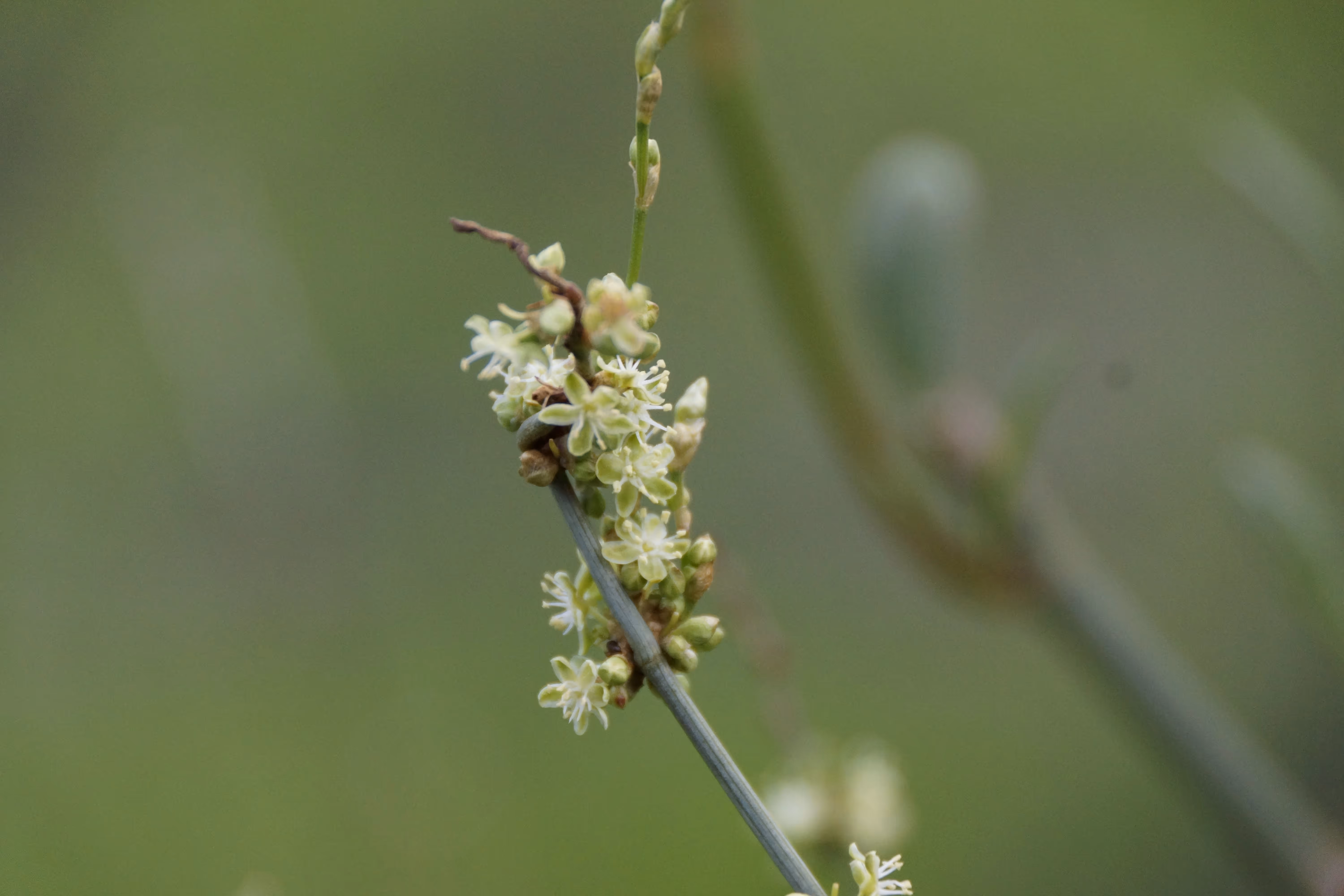
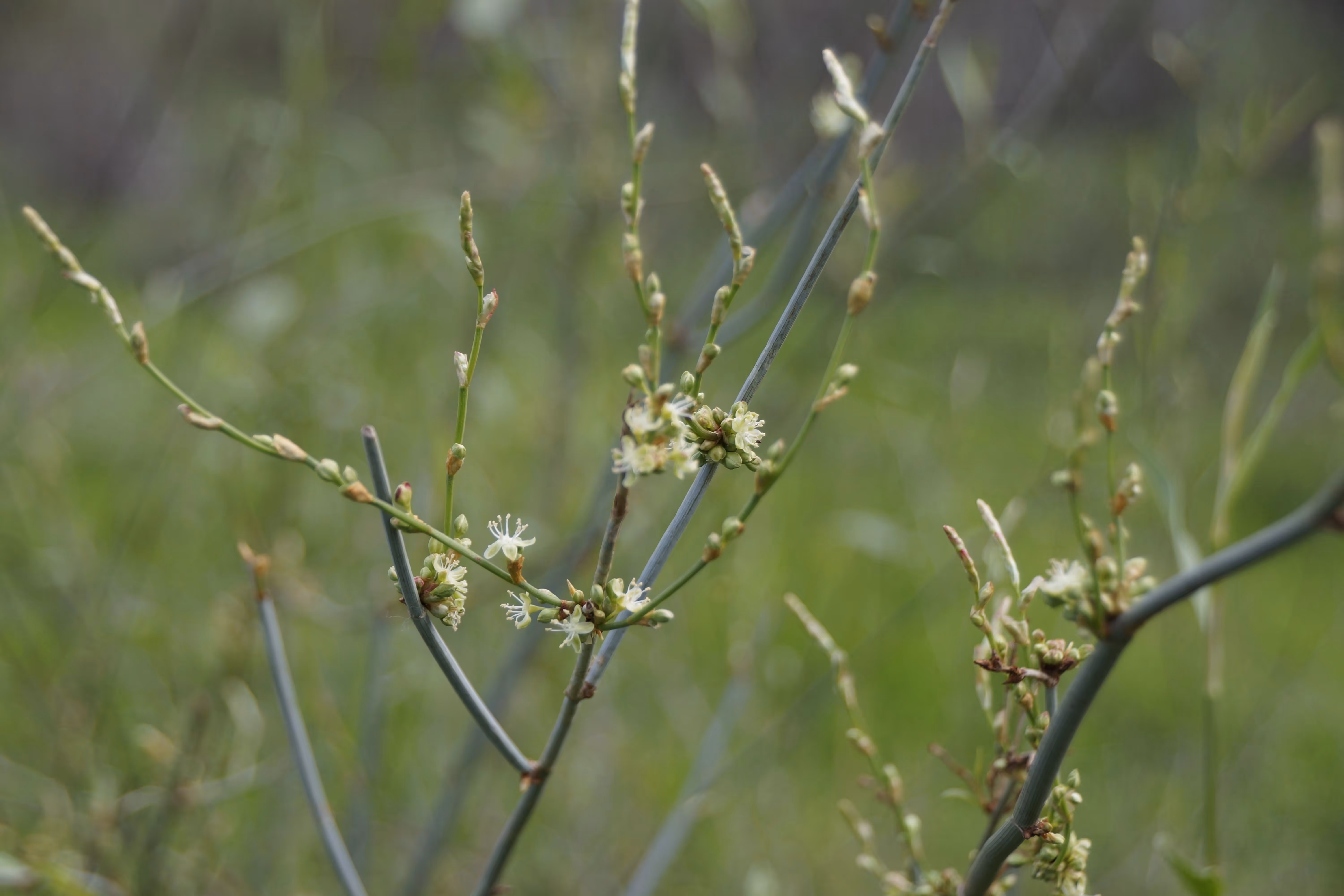
Tangled lignum, Duma florulenta, is a native multi-stemmed woody perennial shrub. It forms dense shrublands on floodplains that experience inundation every 3–10 years. It is common throughout the Murray–Darling Basin, where it often forms dense shrublands on floodplains and temporary wetlands. It is a much-maligned plant and anyone who has had the joy of trying to make their way through a lignum shrubland will attest to its wire-like nature and the impossibility of trying to return the way you came through the tangles! However, it is one of few shrubs that can tolerate the flood and drought conditions of the Basin’s floodplains and, in doing so, it provides important habitat, including nesting habitat for waterbirds such as straw-necked ibis.
.webp)
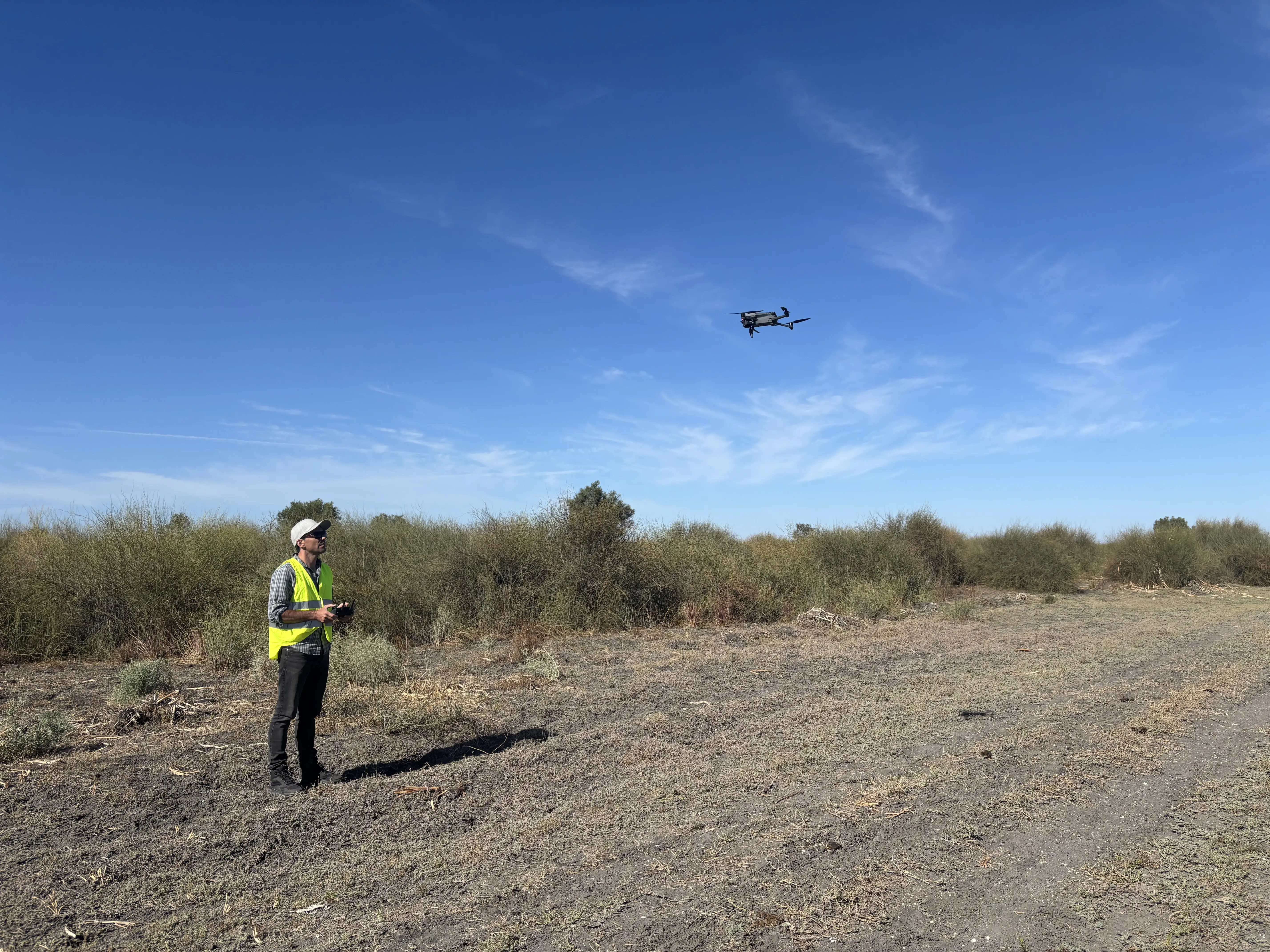
Maintaining the extent of lignum shrubland and improving their condition are expected environmental outcomes of environmental watering in the Basin-wide Environmental Watering Strategy. As part of the Basin-scale Project’s evaluation activities, we focus on understanding the contribution of environmental water to improving lignum shrublands at both the Basin scale and Area scale. This involves using drone-based methods that Will Higgisson and the team at the University of Canberra (UC) developed under Flow-MER. Will first developed drone-based monitoring approaches to overcome the difficulties of monitoring reed beds of the Great Cumbung Swamp. The approach was adapted for lignum in collaboration with the Mallee Catchment Management Authority and the Arthur Rylah Institute.
Lignum can persist through drought periods, often appearing brown and with no leaves, flowers or green stems. It can live in this dormant state for a long time. But when it floods, lignum responds rapidly, producing green growth, developing new stems, lengthening woody stems, and flowering. The appearance and cover of lignum, whether dormant or vigorously growing, is a good indicator of whether the plant has received the water it needs.
Four Area teams – Lachlan River System, Murrumbidgee River System, Mid-Murray River System, and Macquarie River and Marshes – used drones to monitor whether (and how) lignum responded to environmental water in 2024–25. Each Area team collected images in a standard way from areas of lignum shrubland that have different histories of environmental water use. The Area teams uploaded the raw imagery to a central data portal for access and processing by the UC team.
The team stitched together the raw images and clipped them to predefined 50 m × 50 m plots. A deep-learning approach called convolutional neural networks digitally assigned the image contents of the plot to one of 9 classes. The deep-learning algorithm can identify how much of the 50 m × 50 m plot is covered by vigorous or dormant lignum as well as how much is nitre goosefoot, black roly-poly (both shrubs), trees, bare ground, water or other litter. The identification accuracy was 91%, and our methods are continuously improving as the neural networks continue to learn from an ever-expanding collection of images.
After the University of Canberra team processed the images, the images and data were returned to the Area-scale teams in time for inclusion in their annual reports. The Basin-scale team combined the data from all Areas-scale projects for use in the Basin-scale evaluation.
While this process may sound simple, processing the imagery and running the models for a single Area takes our post-doctoral researcher, Rui Lui, around one week. As we add new locations to the image collections, we need more time to improve identification accuracy.
.avif)
.avif)
Want to know more about the methods used here?
Read our preprint article: Higgisson WP, Liu R, Tschierschke A, Cobb A, Jones CS and Vivian L (2025) ‘Spatial method integrating drones and deep learning to monitor floodplain shrub Duma florulenta (tangled lignum) and its response to environmental flows’.

%20(1).webp)
.jpg)