%20(1).jpg)
Managing the highly regulated Goulburn River requires strong science, practical experience, and ongoing collaboration.
At a recent Flow-MER webinar, Lydia Drake from the Goulburn Broken Catchment Management Authority co-presented with Dr Geoff Vietz and Thom Gower from Streamology. Together, they shared how riverbank monitoring and research are being applied to improve environmental and operational water deliveries in the lower Goulburn River.
Turning knowledge into action
Over the past decade, scientists and river managers have worked together to better understand how various flows interact with riverbanks.
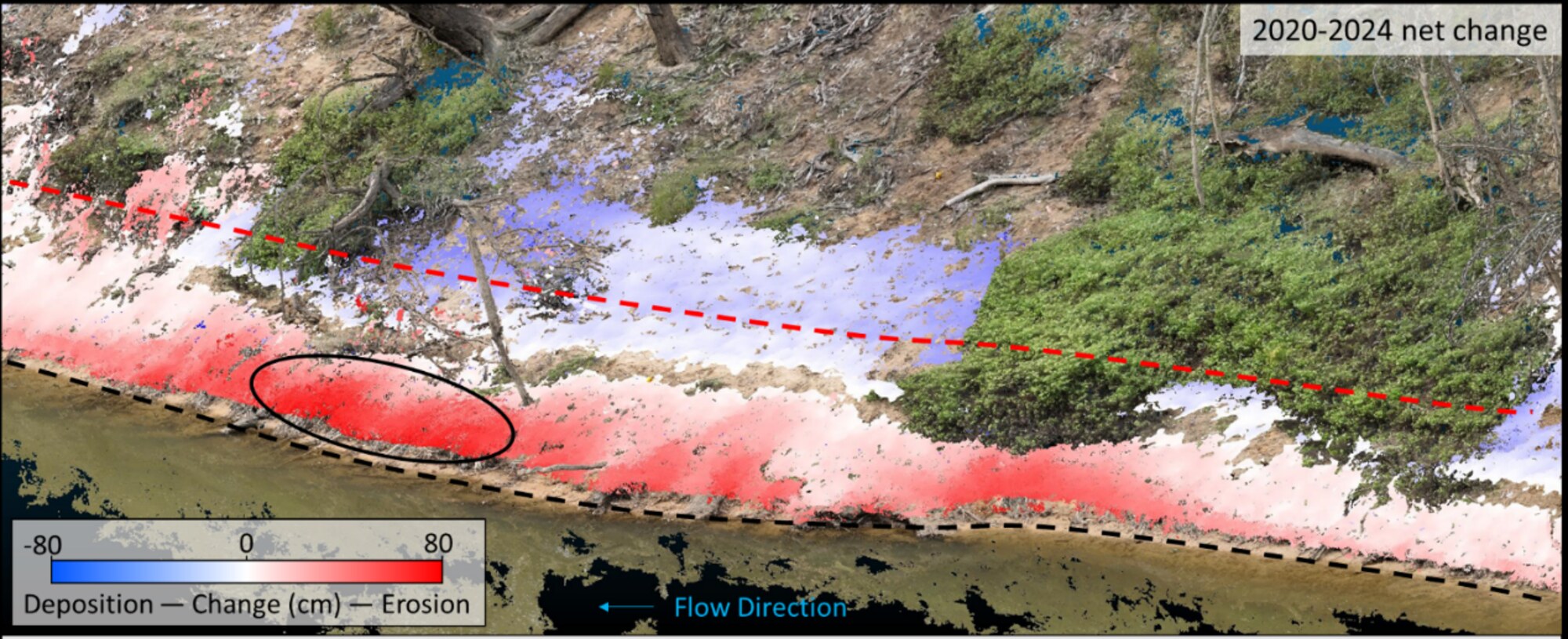
Riverbank monitoring is carried out before and after flow events. These include environmental flows, base flows, and water deliveries such as intervalley transfers (IVTs), which can be delivered as steady flows or short flow pulses. Monitoring has shown that when water levels remain at a similar height for long periods, erosion can become concentrated at specific points along the riverbank. This is particularly evident at the "air-water interface", where the water meets the bank.
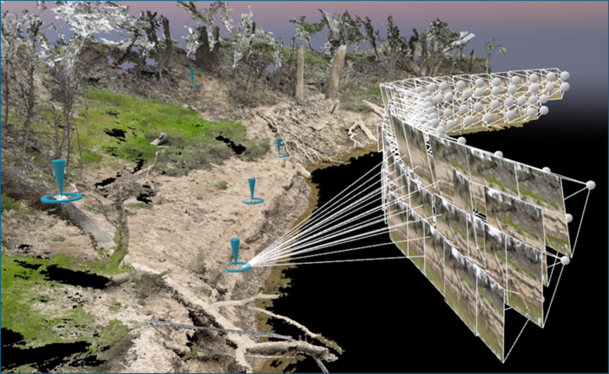
Using drone-based monitoring, Streamology tracked changes in riverbank condition over time. This included responses to specific flow events, as well as cumulative changes across a season or year.
Analysis of drone data collected before and after environmental freshes showed both erosion and deposition occurring along the riverbank. This more balanced pattern reflects natural river processes, where sediment is eroded in some areas and deposited in others.
In contrast, analysis of drone data collected between 2020 and 2024 highlighted cumulative erosion at lower bank elevations where IVT base flows were maintained for extended periods. These insights gave Goulburn Broken CMA the confidence to rethink how flows are delivered.
A new approach to flow delivery
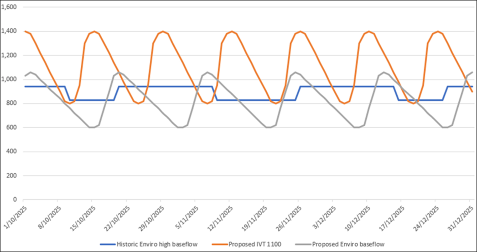
This improved understanding of how flow delivery affects riverbank condition prompted Goulburn Broken CMA to work with key stakeholders, including Goulburn–Murray Water and the Murray–Darling Basin Authority. Together, they introduced more "bank-aware" flow regimes for all flows, not just environmental water.
Rather than maintaining steady base flows, a variable "saw-tooth" pattern is now being used for all base flows delivered along the lower Goulburn River. This allows water levels to move across a broader range of the riverbank. The approach is designed to reduce repeated erosion at the same bank elevation by spreading hydraulic stress more evenly across the bank. It also improves conditions for vegetation establishment.
Initial observations after the new flow regimes were introduced indicate positive results. Less erosion has been observed on vulnerable lower sections of the bank. Improved conditions for vegetation establishment and growth have also been recorded. Target operational water volumes were still able to be delivered despite the changes.
Why riverbank vegetation matters
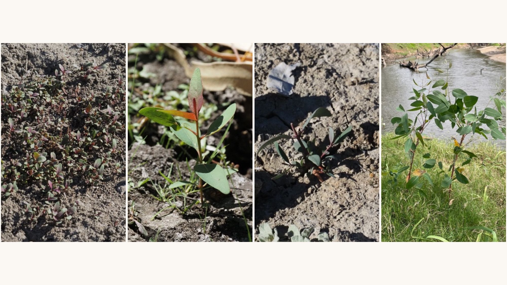
Healthy riverbank vegetation plays a critical role in river systems. It stabilises soil and reduces erosion, provides habitat for wildlife, and supports water quality and ecosystem health.
.jpg)
A monitoring revolution
Traditional vegetation surveys using transects by expert ecologists provide valuable insights into species diversity and cover in response to flow and other influences on bank vegetation. However, these surveys are resource-intensive and cannot easily be applied at a large scale.
New technologies are transforming how riverbank vegetation condition can be monitored across larger areas while complementing detailed local monitoring.
Drone-based surveys combined with machine learning analysis now allow reach-scale mapping of riverbank vegetation. This technique can calculate vegetation cover, bare ground or leaf litter, and woody vegetation. It can also link these observations to the parts of the bank reached by different flow regimes. This will provide a better understanding of how vegetation responds to changing flow conditions.
Working together for better outcomes
A key message from the webinar was the importance of collaboration.
The success of this work relies on strong partnerships between river managers, scientists and researchers, and monitoring teams across the Flow-MER Program.
These partnerships enable long-term data collection and continuity, shared expertise across disciplines, and the practical application of research findings to real-world decisions.
Informing environmental water decisions
Flow-MER plays an important role in ensuring Commonwealth environmental water is delivered effectively. By linking monitoring results with flow planning, water managers can adapt flow regimes to reduce erosion risks, support vegetation recovery, and improve habitat for fish and other aquatic species.
This is a clear example of science informing practice. Evidence gathered in the field is directly shaping how rivers are managed.
Looking ahead
As monitoring methods continue to improve, there is growing potential to better predict how riverbanks respond to flows. There is also potential to apply these learnings across other rivers in the Murray–Darling Basin and support more resilient river systems in a changing climate.
The work being undertaken for the lower Goulburn River is helping build a stronger foundation for evidence-based water management, ensuring rivers remain healthy for both people and nature into the future.
Watch the full webinar: Science to practice: Advances in riverbank form and vegetation monitoring inform environmental flow decisions
.avif)